Share Draft Flat Rock Creek Flood Study on FacebookShare Draft Flat Rock Creek Flood Study on TwitterShare Draft Flat Rock Creek Flood Study on LinkedinEmail Draft Flat Rock Creek Flood Study link
Consultation has concluded
A DRAFT Flat Rock Creek Flood Study has recently been completed. Council now invites local property owners, potentially at risk of flooding in the study area, along with other interested community members to participate in a 2nd round of community consultation by providing feedback on the draft study before 5pm Friday 29 September 2017.
Interested parties are also invited to a public exhibition evening at Council Chambers with Council Staff and the Consultants engaged to undertake the DRAFT Flat Rock Creek Flood Study. Venue: Council Chambers (Level 6, 31 Victor Street, Chatswood) Date and Time: 6pm on Thursday, 14 September 2017
Please register if you plan to attend by responding to the event attendance question in this survey or you can RSVP directly to Councils Drainage / Design Engineer, Scott Kavanagh, on 9777 1059 or via email scott.kavanagh@willoughby.nsw.gov.au
Background:
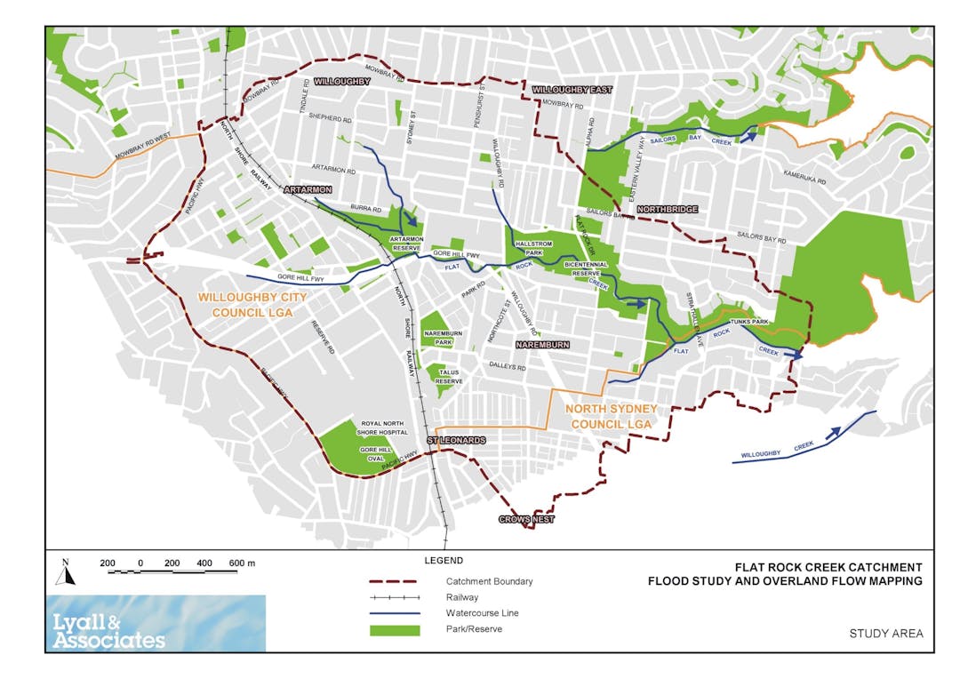
In February this year Council engaged specialist hydrology consultants, Lyall and Associates, to undertake a flood study for the catchments that drain to the Flat Rock Creek area (see catchment study map). At the same time Council undertook a comprehensive community consultation program to capture local knowledge of historical flooding from local residents and incorporate that data into the study. This included a sensitivity analysis of a June 2016 storm which a number of residents reported receiving minor flooding. This information can be found in Annexure A2 of the report.
What's Next:
Stakeholder feedback received during this round of consultation will be used to finalise the Flood Study for Council’s adoption later in the year.
Final steps in the process are to make the updated flood study data available for flood related planning and development controls and development of a Floodplain Risk Management Study and Plan to reduce the risk and severity of flooding throughout the catchment.
A DRAFT Flat Rock Creek Flood Study has recently been completed. Council now invites local property owners, potentially at risk of flooding in the study area, along with other interested community members to participate in a 2nd round of community consultation by providing feedback on the draft study before 5pm Friday 29 September 2017.
Interested parties are also invited to a public exhibition evening at Council Chambers with Council Staff and the Consultants engaged to undertake the DRAFT Flat Rock Creek Flood Study. Venue: Council Chambers (Level 6, 31 Victor Street, Chatswood) Date and Time: 6pm on Thursday, 14 September 2017
Please register if you plan to attend by responding to the event attendance question in this survey or you can RSVP directly to Councils Drainage / Design Engineer, Scott Kavanagh, on 9777 1059 or via email scott.kavanagh@willoughby.nsw.gov.au
Background:
In February this year Council engaged specialist hydrology consultants, Lyall and Associates, to undertake a flood study for the catchments that drain to the Flat Rock Creek area (see catchment study map). At the same time Council undertook a comprehensive community consultation program to capture local knowledge of historical flooding from local residents and incorporate that data into the study. This included a sensitivity analysis of a June 2016 storm which a number of residents reported receiving minor flooding. This information can be found in Annexure A2 of the report.
What's Next:
Stakeholder feedback received during this round of consultation will be used to finalise the Flood Study for Council’s adoption later in the year.
Final steps in the process are to make the updated flood study data available for flood related planning and development controls and development of a Floodplain Risk Management Study and Plan to reduce the risk and severity of flooding throughout the catchment.
Share NEW Flat Rock Gully Survey on FacebookShare NEW Flat Rock Gully Survey on TwitterShare NEW Flat Rock Gully Survey on LinkedinEmail NEW Flat Rock Gully Survey link