
FAQs
- Improvements to flood warning and emergency management;
- Drainage works (e.g. pipe upgrades or detention basins) to protect existing development;
- Planning and building controls to ensure future development is compatible with the flood risks; and
- Measures to raise the community’s awareness of flooding so that they are better able to deal with the flood risks they face.
What is the purpose of the Floodplain Risk Management Study and Plan?
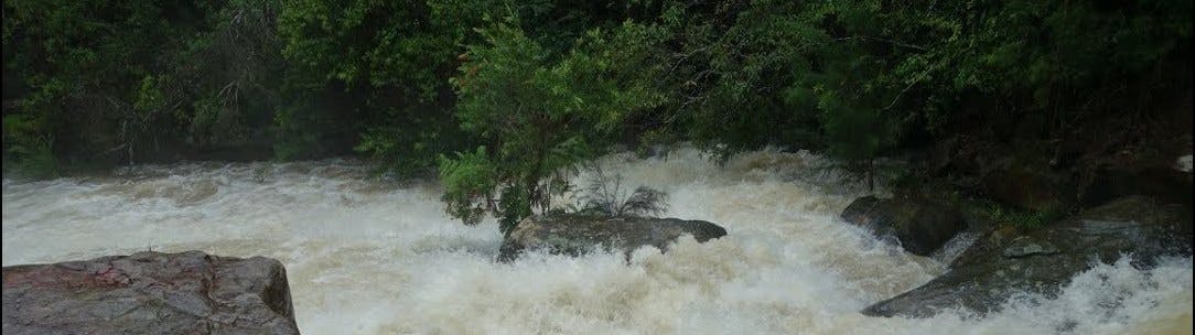
During severe storms across the Flat Rock Creek catchment, there is potential for water to overwhelm the stormwater drainage system and inundate surrounding propertiesand roads. In response to past flood events. Following the completion of the flood study in 2017, Willoughby City Councl received financial assistance from the NSW Floodplain Grants Program to prepare a Floodplain Risk Management Study and Plan
The floodplain risk management study aims to identify, assess and compare various risk management options. Through the study, a strategic assessment considers social, ecological and economic factors relating to flood risk.
One of the most important sources for floodplain risk management studies is community input as many residents would have lived through past flood events . These views will be integrated to the decision making process in the flood management plan, prior to implementing measuresto reduce the risk of flooding throughout the catchment

For more information about the process used to manage flood liable land, a copy of the floodplain development manual developed by the NSW government may be viewed by clicking here.
Under NSW legislation, Councils have the primary responsibility for management of floodplains. To appropriately manage development, Councils need a strategic plan which considers the potential flood risks and balances these against the beneficial use of the floodplain by development. The outcome of the study is the floodplain management plan, which details how best to manage flood risks in the floodplain for the foreseeable future.
Floodplain management plans normally comprise a range of works and measures to manage the flood risk such as:
What is the difference between a Flood Study and a Floodplain Risk Management Plan?
Flood Studies identify flood behaviour including the areas flooded, water depth, hazard and the likelihood of flooding within the catchment. Floodplain Risk Management Studies and Plans assess potential management approaches to reduce the impact of flooding (e.g. drainage upgrades, development controls, community awareness and emergency response arrangements).
I would like further information on Flooding in the LGA?
All of Willoughby City Council's flood studies are publically available online and can be found at the following link. You can navigate to the respective catchment on the left hand drop down box under Floodplain Management. Here you can download the reports of flooding across the Local Government Area.
A direct link to this catchments precursor 2018 Flood Study can be found here:
Finally a more general frequently asked questions can be found here, which provides information on flooding and terminology used in the reports.