
FAQ
- An online community survey which gathered information on existing transport behaviour, attitudes towards cycling, preferred cycle facilities and routes and problem locations for cyclists in Willoughby;
- A school survey which captured the mode of travel to school, the schools support for cycling and cycling facilities and where cycling could be improved; and
- Consultation was undertaken with NSW Roads and Maritime Services (RMS), Sydney Buses, Police (Bicycle Unit), Sydney Trains, BUGS (Bike North) and a council officer (responsible for bike route planning) from North Sydney, Lane Cove, Ku-Ring-Gai and Ryde councils.
- Desktop road and footpath measurements
- Related Council and NSW Government plans
- Policies and technical guidelines
- Constraints in the study area, and
- Site inspections.
- The RMS Bicycle Guidelines which indicate that widths of shared paths should be between 2 and 3 metres (which aligns with AUSTROADS Guide to Traffic Engineering Practice Part 14: Bicycles); and
- The AUSTROADS Guide to Road Design Part 6A: Paths for Walking and Cycling which indicates that a local path should be between 2 and 3 metres.
- 10 m statutory No Stopping on approach/ departure to intersection applies
What are the benefits of this proposal
This proposed regional walking and cycling connection enables the north-south cycle connection and improves the overall safety for walking and cycling along the route. It will connect to St Leonards train station while providing access to existing facilities such as the shared path along the Gore Hill Freeway and adjacent local cycle connections to key places of interest, such as places of work, education and leisure along the way.
Why has this bike route been chosen?
In 2011, an online survey was conducted by Willoughby City Council to identify the existing transport behaviour, attitudes towards cycling, preferred cycle facilities and routes including problem locations for cyclists in Willoughby. A school survey was also undertaken to understand the needs and views of schools relating to cycling. The survey was circulated to all schools in Willoughby LGA. More information on the surveys conducted can be found in the 2012 Bike Plan Review (http://edocs.willoughby.nsw.gov.au/DocumentViewer.ashx?dsi=2811107).
The Pacific Highway was identified in Council’s Bike Plan 2012 as a proposed regional connection which will connect to existing facilities such as the shared path along the Gore Hill Freeway and continue to St Leonards train station. This route forms part of the wider RMS bicycle network. This route will connect to key places of interest, such as places of work, education or leisure. Willoughby City Council looks to create a bicycle network that is suitable for all riders, including those that may not be as confident riding on-road. The proposal seeks to improve north-south connectivity and enhance access to east-west routes within Willoughby that link Chatswood CBD to the wider Willoughby cycling network and further into Lane Cove Council and North Sydney Council LGA’s.
What is a detailed design plan?
A detailed design is a design that is based on engineering survey and provides an accurate representation of the proposed changes. The detailed design is used to construct the approved changes.
What is a concept design?
A concept design is a document prepared in the early stages of a project to develop and test an idea and, if supported, to guide detailed planning. A concept design may undergo changes before being finalised.
What information was used to develop the concept design?
The draft concept design was developed following identification of a key route that would link Artarmon to St Leonards in Council’s 2012 Bike Plan Review and an initial analysis of existing conditions and options.
There was initial engagement with the community and key stakeholders including:
The analysis of existing conditions and options included:
Is this the final revision of the detailed design?
No. The detailed design on public exhibition is a draft only, and no decision has yet been made by Council. A decision will be made only once all feedback has been considered.
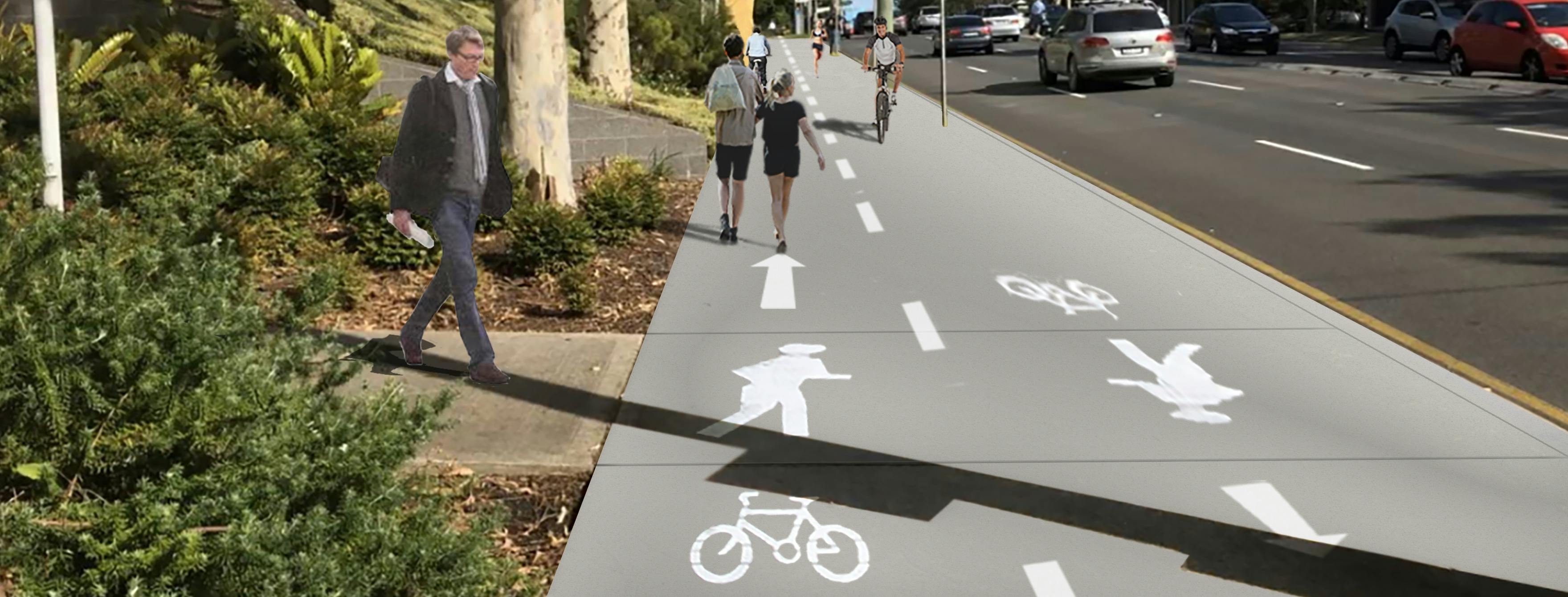
What is a shared path?
A shared path is a path that can be used by people for walking and cycling. Shared paths are often provided when there is no space for a protected bike path and road conditions are not ideal for riding. On shared paths, people on bicycles are expected to give way to people walking, ring the bell and slow down. Additional signage and pavement markings can be used to improve shared path safety for all users.
Why is a shared path proposed, as opposed to a separate cycle path?
Restricted
footpath space means the best option to improve cycle facility provision is
through a shared path. This is the enabling step to allow a higher quality
facility to be developed at a later stage.
Is there enough room for pedestrians and people on bikes to use the shared path?
The shared path will be developed according to:
How will the shared path deal with pedestrian conflicts in restricted areas? How will cyclists be slowed?
In
high conflict areas, such as outside bus shelters, paint and markings will be
utilised to warn cyclists approaching of the upcoming conflict and change in
priority, signalling them to slow. Other methods can also be used, for example textured paving.
Is there a speed limit for cyclists using the shared path?
The
advised speed on a shared path is 30km/h. However the actual speed is based on
the context of the shared path surroundings. A slower speed environment will be
provided for areas of high pedestrian activities such as around bus shelters
and commercial and retail centres.
What happens if I want to pass someone or they want to pass me on the shared path facility on a bike?
Road
user rule of keeping left is advised along the shared path. A directional
shared path marking will be provided as well as a centre line to encourage the
user behaviour. Overtaking therefore is expected to be conducted in a safe
manner.
I haven’t seen many people on bikes on this route – isn’t this a lot of work for only a few?
The number of cyclists currently using this route may be low due to the lack of attractive and safe facilities along the route. Evidence shows that demand for cycling increases with improved cycle infrastructure.
The proposed improvements are not just for people already riding bikes – it’s also for those who are interested but concerned about safety. The survey conducted in 2011 identified the following reasons people would be enticed to cycle:
· 76% of people would like to see physically separated bicycle paths;
· 70% of people want increased driver awareness of bicycle safety and road sharing;
· 55% of people said having more bicycle riders on the road; and
· 30% of people would like increased knowledge of bike routes and bike maintenance.
Council believes the proposed cycle route improvements supports the above points.
What is the impact on street parking?
The detailed design plan will have an impact to the current available on-street parking. The detailed design plan indicates a loss of 2 spaces spread along the route, one space in each of Alto Place and Whiting Street.
The following factors were used in assessing street parking impacts in the detailed design plan:
How is user safety considered for driveways?
In
high conflict areas, paint and markings will be utilised to warn people
walking, cycling and driving that they are approaching the upcoming conflict,
and to be wary of the shared path changes that increased user of both pedestrians
and cyclists
Why can’t we cycle on Pacific Highway now?
Cycling
along Pacific Highway is allowed in the traffic lane within the road
carriageway. Cycling on the footpath is not legally allowed. This shared path
improvement will provide the opportunities for people to cycle on the footpath
level, where separation from the fast moving traffic is provided.
Can I ride on the road?
Cycling
on the road is permitted along Pacific Highway. The proposed shared path will
not impeded that behaviour.
Why can’t the road carriageway space be utilised for cycling facilities?
Will there be changes to bus stops?
There will be no changes to bus stop locations along the route. Some bus shelters will be improved as a part of the shared path project. We are working actively with the bus shelter operator to ensure the improvements are safe and accessible to the existing and new users
The detail surrounding bus stops and bus shelters is on the detailed design plans.
Will I have opportunities to provide feedback?
Yes. feedback on the draft detailed designs for the route using the survey provided as part of the website for this proposal.
What else is Council doing to make it better for people to ride bikes?
Council is also developing plans for other bicycle routes. As bike routes become more connected and continuous, riding a bicycle will continue to become safer, more convenient and more comfortable. Council offers a number of events to promote cycling in Willoughby. Regular bicycle maintenance workshops and cycling skills sessions are held for families, beginner, intermediate and commuter cyclists throughout the year. Council also supports Bike Week and Ride to Work Day which take place late in the year.
Will construction disrupt access to property/services along the route?
Disruptions will be kept to minimum as practicably as possible. Access however will not be
restricted during the construction period.
Will the shared path affect access to properties/services along the route?
The proposed shared path is not expected to restrict or affect the access to properties/services along the route. Cyclists and pedestrians will provided the same right of way on the Shared Path as pedestrians do on a regular footpath.
What is the extent of tree removal /relocation along the route?
Our intention is to plant more trees along the route and the aim is to not remove any trees. However if required each tree will be assessed individually and mitigation / replanting plan will be in place if any tree removal is proposed.