
Additional FAQs from webinars
Willoughby City LEP/DCP Launch Session 6 to 8pm Thurs 17 Mar 2022
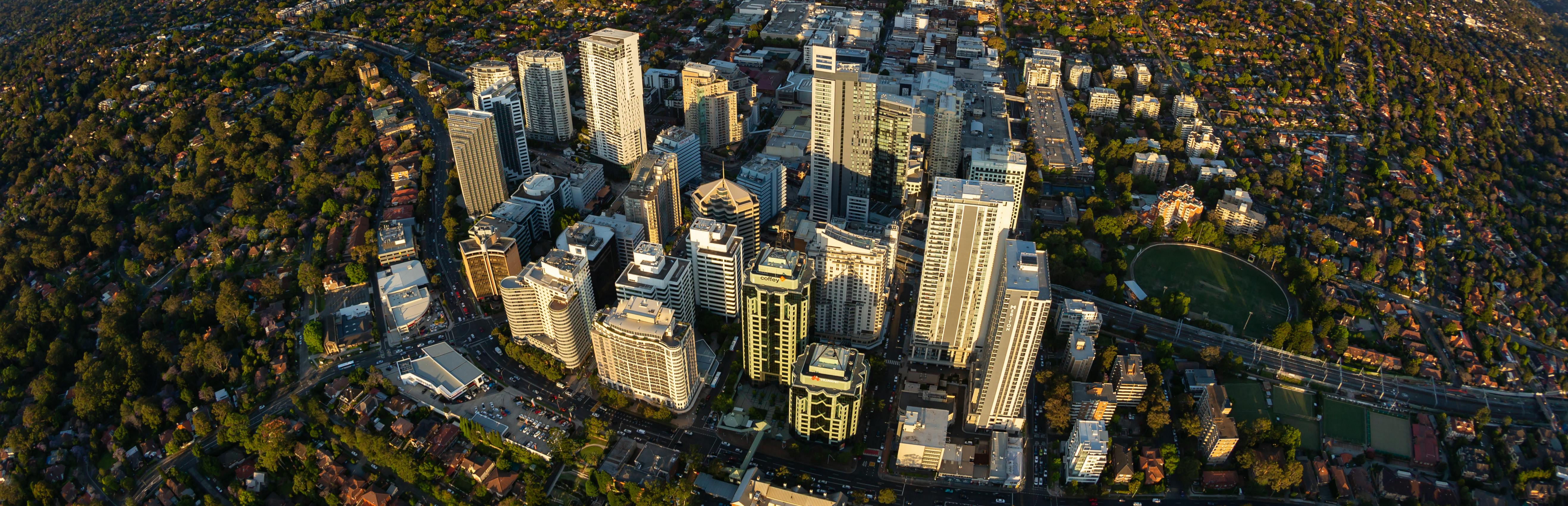
- Chatswood CBD
- St Leonards precinct
- Artarmon railway precinct
When will the new LEP be officially issued?
We expect it will be made early 2023, if no further exhibition is required.
What is the definition of "Affordable Housing"?
Housing is affordable if housing costs are less than 30% of gross household income. Households spending more than 30% of income on housing costs are described as being in housing stress. Housing stress impacts on quality of life and the ability to afford other living costs.
Which centre in Castlecrag is going to be put on the Heritage register?
The Griffin Centre is a proposed heritage item at 120 Edinburgh Road.
Lots of developers have already submitted their DAs, when can they commence construction?
DA approvals are valid for 5 years after which they lapse. Once construction commences there is no time limit to complete the approved works.
Will council implement inclusionary zoning for all developments to fund affordable and community housing? Ask for monetary contributions not % of dwellings.
The draft LEP proposes a change in affordable housing clause in line with the Willoughby Local Strategic Planning Statement (LSPS) to increase the affordable contribution from 4% to 10% of gross floor area where there is a zoning uplift. This will only apply to residential developments or mixed-use proposals where there is a residential component. The contribution can be either cash or kind, however provision of affordable housing units being incorporated in the new developments is preferred as this provides the housing in a more timely fashion.
What are the incentives for property owners to maintain or increase green leafy cover, in line with council objectives?
To strengthen landscaping controls, new provisions have been added to the Draft LEP and supplemented in the Draft DCP for low-density areas. DCP controls for higher density development incorporate quantitative and qualitative controls for landscape provision and protection.
What is the minimum to build a dual occupancy in the dLEP? Currently its 700m2, will this change?
This will not change. 700 sqm for attached dual occupancy, 900 sqm for detached dual occupancy
If we object to the proposals how do we express that?
You can make a submission at www.haveyoursaywillougby.nsw.gov.au or at email@willoughby.nsw.gov.au
What is the landscape percentage for all low, medium to high density housing ?
Clause 6.23 Landscaped Areas in the draft WLEP provides the minimum area required for soft landscaping for lots in the R2 Low-Density Residential and C4 Environmental Living zones. Minimum soft landscape areas for medium and high-density residential areas is 35% of the site area, with a range of 7% to 15% deep soil planting area of the site area to be included in the 35% landscape area total depending on lot size. Refer to Willoughby Development Control Plan Part B: Residential Development – DRAFT 2021 Attachment 3 for more details on these provisions. These DCP controls are unchanged from the existing WDCP provisions.
Don't we need to improve excellence in design in the residential sector too? E.g new houses close to Chatswood High School.
We have a new Design Excellence Clause that will apply to high density residential areas as well as business centres.
It sounds as though the parking around transport hubs is to be reduced. Why?
Council is proposing to introduce maximum car parking rates for new developments in three areas:
These areas are shown in maps on pages 24-26 of Part F (Transport and Parking Management) of Council’s draft Development Control Plan.
If endorsed by the elected Council, these new parking rates do not necessarily mean a reduction in the overall (i.e. existing) parking supply in these areas, but only that there will be less parking required for future (i.e. new) developments, compared to what would have been required in the past under Council’s existing/previous car parking rates (which are ‘target rates’ i.e. neither minimums nor maximums).
This proposed shift to maximum parking rates in these three areas was one of the recommendations from the Review of Parking Rates report completed by consultants Cardno for Council in 2021 (Available at https://www.willoughby.nsw.gov.au/Development/Plan/Planning-Rules/Planning-Strategies#section-13 ). Further details including the reasons are outlined in this report.
Does Willoughby Council discuss and agree plans for zoning / developments with other councils?
Yes - we consult with neighbouring councils for proposed new plans.
What about if i am about to lodge a DA for a battle axe DA. what happens to my application as it appears that council is prohibiting future battle axe developments?
You can still lodge your application for a battle-axe dual occupancy and it will be assessed on its merits against current planning controls. As part of Council's assessment consideration will also be given to the draft LEP currently on exhibition, however, this does not mean that your application will not be approved.
Chatswood CBD already had surplus office and retail space prior to Covid. Expanding shop top housing into what are currently purely residential areas will be negatively effect those areas along Anderson Street adjoining the heritage areas.
The Strategy to grow Chatswood is very long term in order to provide adequate space for residential and employment floor space into the future. The long term impacts of the Covid pandemic are still to play out and Council will keep watch on the impacts in Willoughby.
Would you consider convertng some of the offices to residential (rather than increasing the building height) to achieve your dwelling numbers, if in the future the demand of offices no longer there? Rather than empty.
Council is keen to retain Chatswood CBD as a focus for future jobs as it is identified as a strategic centre in the Sydney Metropolitan Strategy and up to 8,300 additional jobs are forecast to be created. The evidence is that the pandemic has not reduced the demand for future jobs in attractive and well located centres such as Chatswood.
Shop top housing - Do we actually know that this model works in Chatswood or anywhere else? Any research on real outcomes would be good, other than additional options for developers ? Thanks
Shop-top housing is a well recognised and successful housing form in local and larger regional centres such as Chatswood. While not always feasible in all locations it offers the opportunities for mixed use developments that will provide both housing and commercial ground floor uses which contribute to the vibrant character of these areas.
If you increase the density in the Chatswood CBD, how are you going to provide the open green space mentioned earlier in the presentation?
The Chatswood CBD Planning and Urban Design Strategy proposes additional areas of open space where possible and encourages the inclusion of landscaped areas around new development and on podium levels. These green roofs will also provide potential additional opportunities for communal recreation areas in the CBD. Further improvements include pedestrian linkages throughout the CBD.
What happened to graduating heights instead of sudden tall buildings in centres such as Chatswood?
In Chatswood CBD the proposed change in building heights will be managed by a range of planning controls including setbacks, gradation in building heights to adjoining residential areas and sunlight and landscaping controls.
Chatswood LEP/DCP Webinar Thurs 17 Mar 2022
In Sun Herald 20 March tree cover has reduced in WCC to 41% in 2020 by 3% from 2016 Does plan address this to increase cover
We recognise the importance of increasing tree coverage. The new LEP proposes a new landscaping clause which seeks to increase landscaped area and trees when new development or redevelopment occurs throughout the Willoughby LGA.
Council's data shows that in 2016 the tree canopy cover in Willoughby was 36%. Council's LSPS has a goal to increase tree coverage to 40% by 2036.
Why do you see it as self evident that Chatswood needs to be a bigger CBD? It’s a negative for existing residents. Sydney and NSW has lost population, so there’s no clear need
Council needs to respond to State government requirements for population growth to be catered for in all parts of Sydney and in regional NSW. While population growth may have slowed during the pandemic, this has been identified as a short-term trend by the State Government and locations such as Sydney will continue to grow into the future. Chatswood has been identified as a regional centre in the North District Plan and therefore there is a particular focus on this centre for future growth in both jobs and housing.
How do you improve walkability of the streets when adding much more density with 90m towers in defined Chatswood CBD area? And when we walk to Chatswood West from East, how the high street type of Chatswood Pacific Hwy can be improved and addressed?
The Chatswood CBD Planning and Urban Design Strategy 2036 identifies a number of potential mid-block and through-site links that aim to improve walkability within the CBD. Other measures to improve walkability and the urban environment include building setbacks, ground floor activation and landscaping provisions.
What is the maximum number of stories in the area adjacent to the South Chatswod Conservation area?
The Chatswood CBD Planning and Urban Design Strategy have proposed building heights bordering the South Chatswood Conservation Area typically 23m (approximately 7 storeys). The part of the conservation area with the CBD proposes a gradation of building heights from 90m down to 23m and 11m bordering the remainder of the conservation area. There are also additional building setbacks and landscaping requirements within the draft LEP and DCP to reduce the impact on the adjoining conservation area.
How will you address the heat island effect around the CBD - so much concrete - so will greenery
The Chatswood CBD Planning and Urban Design Strategy proposes additional areas of open space where possible and encourages the inclusion of landscaped areas around new development and on podium levels. These green roofs will also provide potential additional opportunities for communal recreation areas and address the heat island effect in the CBD. Further improvements include pedestrian linkages throughout the CBD.
What plans are there to optimise the street scape ? (For example use of integrated smart poles for lighting, WiFi, EV charging, parking metering, mobile cells rather than the ugly proliferation of piecemeal infrastructure)
A Chatswood CBD Public Domain Plan and Technical Manual has been prepared as a guide to support and promote an active and healthy community through the delivery of resilient public realm and streetscape enhancement. Like many arterial roads, the Pacific Hwy is a noisy, busy road corridor. Nevertheless, Council believes the appearance and amenity of the road can be improved and strengthened, primarily through the idea of a green setback as per page 21 of the Chatswood CBD Strategy.
Note the Pacific Hwy is a state-controlled road and therefore traffic control and overall management is the responsibility of Transport for NSW. Nevertheless, Council works with Transport for NSW to improve safety at known blackspots.
How does the new LEP protect the view corridors from existing residential towers within the Chatswood CBD ensuring that amenity and livability is maintained?
It is inevitable with new development proposed in the Chatswood CBD that some existing views will be at least partially affected. Consideration of the new development proposals will consider the impact on views from existing developments is part of a range of matters to be assessed. Council considers the principle of view sharing for both existing and new developments are part of its planning assessments.
East to west passed the CBD and across the Pacific Hwy is just about impossible on busy days - it urgently needs to be addressed - what is being done?
An appropriate balance is sought between motor vehicles utilising this State significant road and pedestrians' ability to cross from one side to the other. Opportunities to improve access across the Pacific Highway is continually explored. The Chatswood CBD is a fully developed urban area with very good accessibility by active (walking and cycling) and public transport (train, bus and metro) modes. Continued growth in travel by private vehicle would be difficult to be accommodated by the CBD road network, which has no capacity for further expansion. As such, Council is employing travel demand management (TDM) as one of the guiding principles of the Chatswood CBD Strategy and Chapter F (Parking and Traffic Management) of its draft DCP. TDM is a transport planning concept that employs various strategies to reduce and/or redistribute travel demand, including promoting trips by active and public transport modes over private vehicles. By using TDM strategies, Council aims to minimise further congestion in the Chatswood CBD into the future.
Understanding that some of these questions may not be answered in this webinar due to time, will Council be addressing these separately (i.e. FAQ)?
Live responses are included in the webinar recording made available the following day at https://www.haveyoursaywilloughby.com.au/lep-surveys-docs22
Some general comments from webinars have been made available here.
What is 'street activation’'?
Street activation is the uses, activities and building elements that provide interaction with people on the street such as shop display windows and alfresco areas.
Council states it is required to have 6700 new dwellings by 2036. How do you know that 6700 new persons or families actually will want to live here? How is this researched?
Council uses demographers to assess future populations and households. See link below:
How can the image representing 'future Pacific Hwy' is viable? What about Traffic control? Overcrowded & black spots on corners between Pacific Hwy with Help St & Victoria Ave
The Chatswood CBD Strategy has been previously referred to Transport for NSW. No objections from Transport for NSW were raised to setbacks proposed along the Pacific Highway or the principle of greening within setbacks and street trees. Any street tree planting would be done in consultation with Transport for NSW. In regards to planting within setbacks, a mix of trees (with appropriate canopy coverage) and low-level vegetation is envisaged. The Chatswood CBD Strategy is intended to work with other objectives such as traffic control and pedestrian safety. It should be noted that the illustrations are indicative only.
What impact would a wall of 90m buildings in Anderson St. have on adjacent residences to the west?
The Chatswood CBD Planning and Urban Design Strategy 2036 addresses floor plate size maximums, setbacks to adjoining areas through building setbacks and landscaping controls. The intention is for proposals to satisfactorily address the slender tower objective, and provide design solutions that mitigate building bulk and scale.
The plan for cnr of Mowbray & Hwy should include a right hand turn into Mowbray travelling Sth on Hwy. The Metro site could be realigned to retain three lanes going Sth and include the new right hand lane.
Council will be involved in any redevelopment of the dive site. Improving traffic movement around the dive site will be an objective of Council. It should be noted that the Pacific Highway is a State significant road, and as such the final decisions in regards changes to the Pacific Highway will be made by Transport for NSW. Council staff are continuing to liaise with Sydney Metro and Transport for NSW regarding any changes to this intersection. However, it must be acknowledged that any upgrades would be difficult and expensive given the location of heritage items on three of the four corners of the intersection. Transport for NSW would lead a comprehensive engagement process to ensure that any changes proposed are supported by the majority of affected residents and businesses.
The proposed development of CBD Sth towards Mowbray Rd allows excessive maximum heights for new developments. Would not a more healthy, human-scale and aesthetic result be achieved by having the maximum heights gradually lower towards Mowbray Rd?
The CBD Strategy proposes a reduction in building heights from 90m to 53m for the Metro "Dive" site on Mowbray Road.
“Vibrant green community” - how many hectares of new parkland are being provided (Not commercial areas or footpaths)?
The opportunities for 'hectares of new parkland' are limited in a CBD context. An objective of the Chatswood CBD Strategy is to achieve landscaping at ground level within setbacks and deep soil planting, green roofs at podium levels (in particular visible from the street), and vegetation on walls and at roof tops in an appropriate setting. A further objective is to increase the public realm via through site links, pocket parks, widened footpaths and increased ground level public spaces. It is further intended to embellish existing public open space through improvements.
I don’t understand why Council insists on such high rise buildings (albiet slimline) next to residential conservation areas? Why can’t there be a balanced approach?
In Chatswood CBD the proposed change in building heights will be managed by a range of planning controls including setbacks, gradation in building heights to adjoining residential areas (including heritage conservation areas) and sunlight and landscaping controls.
What opportunities exist for local neighbour engagement on Complying Developments / Dual Occupancies?
The draft LEP looks to align with the Complying development rules for dual occupancy development. We are seeking public views on this change.
What is the town planning to create more parking and reduce congestion?
"With increasing density and traffic in centres it will become more important for these areas to be less reliant on private cars and parking and more dependent on public transport and active transport modes. It is now generally understood that there is a strong correlation between road space/parking supply on the one hand and traffic generation/congestion on the other. Traffic expands to fill road space due to the phenomenon of ‘induced demand’. Furthermore, in an already built-up area like the Willoughby local government area, there is little scope to continue to expand roads and intersections.
Given these facts, the growth in population and employment in the Willoughby local government area is planned for areas close to railway/metro stations and existing CBDs and local centres. This is known as ‘transit oriented development’ and the overall intention is that residents and workers in these areas will be able to walk, cycle or use public transport for a greater proportion of their trips, instead of private car. This will not only minimise further travel by private car and traffic congestion but also contribute to greater health and wellbeing, lower emissions and greater amenity in general.
Any planning to have recreation centre for more sports courts and swimming pools for exercise within Chatswood?
"There are no specific plans for an indoor recreation centre in Chatswood at this stage. Chatswood however has a wide range of sports choices for local residents depending on their recreation interests. These recreation choices are spread over various sites, and not centred in one location due to the facility needs of each sport. Residents can choose basketball, netball, tennis, cricket, croquet and rugby within the Chatswood CBD. There are also indoor fitness centres offering the full range of exercise programs.
Within the City boundaries, there is the Willoughby Leisure Centre which offers swimming and indoor court sports, such as netball, basketball , badminton and volleyball. Other sport choices within the City are squash, baseball, golf, lawn bowls, football and futsal."
Why not make the FSR and building heights bigger for land beside Pacific Hwy and Trainline. e.g. 150m commercial core between Pacific Hwy and trainline, but keep the current LEP for land beside conservation area
In Chatswood CBD the proposed change in building heights will be managed by a range of planning controls including setbacks, gradation in building heights to adjoining residential areas and sunlight and landscaping controls. After careful urban design analysis including sunlight impacts on the public domain and nearby areas it was determined that a maximum building height of 90m in peripheral CBD areas as appropriate, with a gradation of reduced heights to adjoining areas including the heritage conservation areas. For areas in the commercial core of the CBD, including to the west of the Pacific Highway, maximum heights up to RL 246m are permissible (this maximum height varies depending on the site, but is approximately 150m). This is the maximum height permitted due to aircraft flightpath limitations. It should be noted that solar access protection affects some of the RL 246.8m and 90m maximum height areas. This means in these affected areas a lower maximum height is achievable. Impacts on height adjacent heritage conservation areas has been considered, with transition provided where appropriate, which has been supported by Department of Planning and Environment in their endorsement of the Chatswood CBD Strategy on 9 July 2020.
Is the minium for dual occupancy 730m2 now?
700 sq m for attached dual occupancy and 900 sq m for detached dual occupancy.
COVID - why are we looking at towers and apartments that only seem to profit developers in existing areas rather than pushing back the government to expand Sydney and surrounding areas into low density affordable housing?
The strong focus of the State Government's strategic planning for Sydney is that higher density living areas are located in close proximity to existing centres. This is to ensure that areas closest to employment and service centres as well as public transport are the focus for a higher population increase due the enhanced access available for these areas. This policy is reflected in the North District Plan and Council's Local Strategic Planning Statement and Housing Strategy. This policy also protects the character of existing low density areas.
How do you enforce that 10% must be affordable housing? Are there incentives to build such housing? Is it something only for the Developers to use as an offset for something else.
The affordability requirement of 10% is included in the draft LEP and will be a condition of development consent.
To have high density dwelling at CBD area will create high level of noise. Is CBD really suitable for Apartment living?
Future apartment developments and adjoining developments in the Chatswood CBD will be required to meet State Government legislation in relation to noise abatement and control. This will ensure that an acceptable living environment will be achieved for these developments.
Where can I view the draft LEP?
The draft LEP can be viewed on the NSW Planning Portal at the following link www.planning.nsw.gov.au/About-Us/NSW-Planning-Portal.
It’s factually wrong to say NSW has inevitably growth. NSW is in population decline
While there has been a temporary slow down in population growth in NSW the population is forecast to contnue to grow. Further information on population forecasts for Willoughby LGA is available at https://forecast.id.com.au/willoughby
Regarding the proposed increased building height along Pacific Hwy: How is Council considering overshadowing the residential on the western side of the Highway and further down the hill.
Council has carefully considered the overshadowing impacts of the proposed height controls for Chatswood, with particular regard to key public spaces. Heights have been reduced to ensure key public spaces are protected. In regards other overshadowing, the CBD Strategy has a suite of controls that are designed to allow thin towers that have fast moving shadows - maximising solar access between 9am and 3pm. Meaning that on the western side of the Pacific Highway, properties may be affected in the early morning, however as the day progresses the shadowing will move to the eastern side of the Pacific Highway.
I am concerned about the zoning for the Chatswood Bowling Club adjacent to the Chatswood croquet club area?
The zoning for the Chatswood Bowling and Croquet Club is RE2 Private Recreation zone. There is no plans to change this zone in the draft LEP.
St Leonards LEP/DCP Tuesday 5 April 2022
Why wasn't there more open space planned in the Crows Nest Metro Over Station Development?
The Crows Nest Metro Over Station Development is a State Significant Development, meaning a Local Council is not the determining authority for the proposed Over Station Development
Does Council agree with 2018 draft St. L/Crows N 2036 masterplan shows the RNSH area planned as an area for Health and Education
Council supports The RNS health precinct being retained for health-related purposes.
Concern about high rise develeopment risking the flight path for the RNSH hospital helicopter land pad
We are consulting with Sydney Airport and The CAA regarding proposed heights. Dept of Health is also being consulted as part of this exhibition.
207 Pacific Highway St. Leonards has possibly the best piece of planning in the area. If this site is redeveloped would the plane trees on the Pacific Highway and the 12M setbacks all around the building remain?
A 3m setback is required under the St Leonards Crows Nest 2036 Plan. Any impact on plane trees would be assessed at DA Stage.
Concern about expansion of Chatswood CBD and overshadow of Chatswood Oval
The Draft LEP includes a new Sun Access Clause to protect kep public open spaces such as Chatswood Oval.
Increased FSRs would mean increased populations including families. What provisions are made for additional schools, health facilities, sporting facilities, etc?
The St Leonards 2036 Plan considered this and included a proposed funding mechanism for this type of infrastructure.. This is now subject of review by NSW government.
Concerns raised about tree removal canopy and tree removal for various sites.
For proposals on state, government sites would come to Council for assessment, Council's policy is that 3 trees replace any one removed. It is the responsibility of the State government department to uphold Council's assessment. Stage 2 of Gore Hill has no final design at this stage. Chandos Street - street planting is assessed when sites are redeveloped. The playground at Gore Hill is proposed to have shade sales as requested by playground users. Refer to the following link regarding the question on bicycle paths as this relates to a separate project. Please view https://www.haveyoursaywilloughby.com.au/Chatswood_StLeonards_PBN
High density living can work very well, but any new high-rise buildings should be sympathetically designed and located so as not to impact on the lifestyle of existing high-rise occupants
Any proposed new development is subject to a development application that requires an assessment with regards to aspects such as overshadowing, view loss, setbacks, requirements in the Apartment Design Guideline, and many more controls to take into consideration. I agree with you that high-density buildings should be designed with a high level of quality to ensure living standards can be maintained.
Castlecrag LEP/DCP 6 & 12 April 2022
The recent DA for 3 the Postern has not provided for the activity street frontage as adopted in the Castlecrag Local Centre Strategy. This should be strengthened in the LEP control for Active Street Frontage.
Street activation is an important consideration for the Planning Proposal for The Quadrangle, particularly for Edinburgh Road. The draft LEP proposes that Active Street Frontages map will apply to all the commercial sites in the Castlecrag commercial centre, including 3 The Postern site. This means that active street uses such as commercial or community uses must be located on the ground floor and directly address the street. The DA approved for 3 The Postern is for commercial uses. If you wish, you may lodge a submission for the Planning Proposal when it is on public exhibition.
Are the FSR's proposed to be fixed on a lot in the LEP, or flexible, on a merit basis discussed with Council, and contained in the DCP?
Council propose to change the Floor Space Ratio to a Gross Floor Area calculation for lots in the residential zones not within Heritage Conservation Areas or Conservation Living Zones. The resulting floor area will depend on site area and the DA process will still be merit based.
Is there enough provision for older, less mobile residents in the Crag central shops area ? Removing parking for those older persons who need handy access to services does not lead to a ‘liveable’ environment. How is this to be addressed?
Despite the loss of the existing spaces for public parking outside the Griffin Centre in Castlecrag, it is intended that current levels of parking spaces available in the Castlecrag commercial centre for the public will be maintained. This will include provision of adequate car spaces in the proposed Quadrangle development to compensate for loss of parking spaces in front of the Griffin Centre.
The Innisfallen Estate area in Castle Cove has different controls from the E4 controls in the rest is Castle Cove. Will this continue?
No changes are proposed in the draft LEP for the Innisfallen Estate.
There was mention of ‘no battle axe formation’ developments. What about developments such as ‘studios’ on top of garages and in front yards?
No changes are proposed for what we call "secondary dwellings" to a maximum of 60 square metres.
What criteria tip a CDC to a DA?
If the proposed development meets the criteria under the State Environmental Planning Policy (Exempt and Complying Development Codes) 2008 it can be assessed under this SEPP as complying development. These criteria are numerous and can be viewed in the SEPP but include such things as forward of the established building line on the street frontage. If it does not meet the requirements of the SEPP a development application will need to be lodged with Council and assessed by either Council or a private certifier.
Your various presentations have targeted ‘reducing car use’ - but there are some who need their car and you have made specific rezoning re parking.
It is intended that current levels of parking spaces available in the Castlecrag commercial centre will be maintained. Despite the loss of the existing spaces for public parking outside the Griffin Centre in Castlecrag, it is intended that current levels of parking spaces available in the Castlecrag commercial centre for the public will be maintained. This will include provision of adequate car spaces in the proposed Quadrangle development to compensate for loss of parking spaces in front of the Griffin Centre.
There has been no specific mention of the properties 114/116 and 118 Edinburgh Road. Where do these properties sit in relation to the proposed changes in height along the south side of Edinburgh Road from Eastern Valley Way to the Griffin Centre?
The heights at 114-118 Edinburgh Road are not proposed to be changed from the existing height of 9m. The proposed height of building of 100 Edinburgh Road is proposed to change from 9m to 11m on Edinburgh Road and from 9m to 14m on the rear half of the site. You can lodge a submission regarding this at https://www.haveyoursaywilloughby.com.au/lep-surveys-docs22
Northbridge LEP/DCP Wednesday 27 April 2022 17 Mar 2022
Concern about loss of parking and traffic - My understanding is that under part of the Northbridge "re-design", is that 2 road lanes will be closed east of the junction (Sailors Bay Rd and Strathalen Ave).
This is not part of the LEP / DCP proposals. It is presumed that the question might relate to the Northbidge public domain proposals. However, that project does not propose to reduce road lanes.
With the change in the Dual Occupancy controls, does this mean the requirement to create sperate titles no longer contains the 5 yr restriction period as is in the current LEP?
The requirement for the five year period before subdivision can occur for a dual occupancy is proposed to be removed to align with the State Environmental Planning Policy (Exempt and Complying Development Codes) 2008 for dual occupancies.
Is there a reason why southern side sbr (sailors bay rd) height and FSR are very different from the northern side
Heights are proposed to transition down to lower controls as they get closer to lower density residential areas to the south.
Do the mimimum lots sizes for Dull Ooccupancy need to comply with LEP min lots size or SEPP?
The LEP minimum lot size.
Naremburn LEP/DCP Thursday 28 April 2022
Some proposed building heights talk of number of "Storeys" (eg; 4 storeys), and some refer to height in "meters". For clarity, which is proposed to be in the LEP? If it is "meters", will protrusions for lift cores, solar panels o nroor etc be allowed?
The proposed height will be stipulated in metres in the WLEP. Any breach in height limit will require a request to exceed the height limit in accordance with Clause 4.6 of the WLEP.
What does "reduction of parking requirement for railway precincts" mean? Parking in local streets within a km of station is becoming more and more difficult, even short-term parking.
This refers to the proposed lower parking requirements for new developments close to the three railway stations in the Willoughby local government area - Chatswood, Artarmon and St Leonards. This is to recognise the excellent accessibility of these areas, particularly by public transport and to minimise further traffic congestion. These rates were recommended in the Review of Parking Rates report completed for Council last year. This report is available here: https://www.willoughby.nsw.gov.au/Development/Plan/Planning-Rules/Planning-Strategies#section-13
The Review of Parking Rates report, problem is people who live near stations still have cars - and they park them in local streets. Part of the problem in Naremburn streets near St Leonards station comes from North Sydney Council buildings.
You are correct that there is always high demand between different parking uses in a place like St Leonards-Naremburn (e.g. residents, workers, commuters). Council's Street Parking Strategy defines how Council manages these competing demands and can be found here: https://www.willoughby.nsw.gov.au/Residents/Parking-and-Transport/Parking/Willoughby-Parking-Strategy
If I belive a property is zoned incorrectly - i.e. the zoning does not match the current streetscape - what is the best way to make a submission?
To make a submission go to on what the LEP / DCP is proposing go to www.haveyoursaywilloughby.com.au
re conservation areas, what does ‘information required for justifying demolition’ include? what are the changes in that area?
The WLEP and WDCP currently stipulates that demolition of a building in a heritage conservation area is not supported by Council and there is no change to this policy. Any proposal to demolish a building within a heritage conservation area is required to provide information in accordance with the requirements as stipulated within Helou v Strathfield Municipal Council [2006] (paragraph 43-46), which is a recognised planning principle with regards to demolition of buildings within heritage conservation areas.
What is the definition of "landscaping requirements"? Is there any requirement for native plants? Large areas of grass or water hungry non-natives do not enhance the canopy or encourage biodiversity
Landscaping requirements for sites are generally expressed as a percentage of site area (i.e. a percentage of the site must be impervious surface). Council encourages native plants, and specific landscaping requirements are also dependent on the land zoning; for example a heritage conservation area, or the type of development.
Is there any opportunity to discuss a specific site with anyone from council?
You may contact the Strategic Planning Team on
Phone: 02 9777 1000 or
Email: email@Willoughby.nsw.gov.au
What is the definition of affordable housing?
Housing is classified as affordable if housing costs are less than 30% of gross household income. Households spending more than 30% of income on housing costs are described as being in housing stress. Housing stress impacts on quality of life and the ability to afford other living costs. More information can be found here: https://www.willoughby.nsw.gov.au/Community/Community-services/Affordable-Housing
Artarmon LEP/DCP Tuesday 3 May 2022
Does urban heat clause apply to both commercial and residential development?
The urban heat clause will apply to both commercial and residential development.
Industrial Lands LEP/DCP Tues 17 May 2022
Do the new development controls push buildings further back from the boundaries?
There are no changes proposed to existing setbacks in industrial areas. See this section Willoughby Development Control Plan Part E: Industrial Development
Why is Willoughby Industrial identified for doggie daycare and wouldn't this use be similar to childcare centres where multiple visitors will be entering into the area and requiring areas for play.
The issue relates more to the suitability of the use in an industrial location. Childcare centres across all of Willoughby’s industrial areas are recommended to be prohibited for the health and wellbeing of children due to potential hazards associated with industrial activities such as excessive noise, pollution and the operation of heavy machinery / vehicles within the area. Childcare centres would be encouraged to locate in more suitable alternative locations which would provide a healthier environment for children. Whereas doggy day care is seeen as apporpriate in an industrial area as the use may generate noise and odours and is proposed to be able to be accommodated in East Chatswood Industrial area without impacting amentity if located away from residential areas.