
FAQ
- The RMS Bicycle Guidelines which indicate that widths of shared paths should be between 2 and 3 metres (which aligns with AUSTROADS Guide to Traffic Engineering Practice Part 14: Bicycles); and
- The AUSTROADS Guide to Road Design Part 6A: Paths for Walking and Cycling which indicates that a local path should be between 2 and 3 metres.
- Provide a shared path on a short length of Castle Cove Drive.
- Provide a shared path along or parallel to, the southern footpath of Castle Cove Drive.
What are the benefits of this proposal
The bicycling route enables an east-west cycle link connecting residents and visitors in Castle Cove to local shops in Denawen Avenue, buses along Eastern Valley Way, businesses in the Chatswood East Industrial Area, High Street Local Centre and Chatswood CBD.
The bicycle link will improve the overall safety, access and amenity for bicyclists and encourage more people to ride a bicycle, reduce congestion and support more healthy and active lifestyles. The speed reduction measures in Deepwater Water Road and Neerim Road will improve safety for motor vehicles.
It will provide improved bicycle connection and facilities for workers and visitors in the Chatswood East Industrial Area along, and in the vicinity of, Smith Street. The improved route will link with existing routes to to/ from Chatswood CBD and thereby encourage higher use bicycle to travel to work and other needs.
The bicycle route provides the potential for future extension toward the Castle Cove shops for local shopping needs as well as places of interest, such as places of work, education and leisure thereby increasing its attractiveness to potential bicycle users.
What is a concept design?
A concept design is a document prepared in the early stages of a project to develop and test an idea and, if supported, to guide detailed design. A concept design may undergo changes before being finalised.
Is this the final revision of the concept design?
No. The concept design on public exhibition is a draft only, and no decision has yet been made by Council. A decision will be made only once all feedback has been considered.
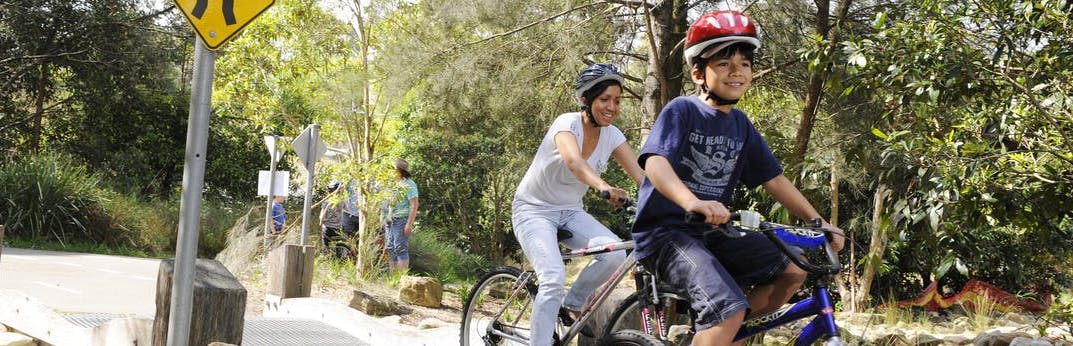
What is a shared path?
A shared path is a path that can be used by people for walking and cycling. Shared paths are often provided when there is no space for a protected bike path and road conditions are not ideal for riding. On shared paths, people on bicycles are expected to give way to people walking, ring the bell and slow down. Additional signage and pavement markings can be used to improve shared path safety for all users.
Is there enough room for pedestrians and people on bikes to use the shared path?
The shared path will be developed according to:
Is there a speed limit for cyclists using the shared path?
The
advised speed on a shared path is 30km/h. However the actual speed is based on
the context of the shared path surroundings. A slower speed environment will be
provided for areas of high pedestrian activities such as around bus shelters
and commercial and retail centres.
What happens if I want to pass someone or they want to pass me on the shared path facility on a bike?
Road
user rule of keeping left is advised along the shared path. A directional
shared path marking will be provided as well as a centre line to encourage the
user behaviour. Overtaking therefore is expected to be conducted in a safe
manner.
How is user safety considered at driveways?
In high conflict areas, paint, markings and signs will be utilised to warn people that they are approaching an upcoming conflict area, and to be aware that other modes of transport may be around.
What about impacts to on-street parking?
The proposal removes 4 on street parking spaces on Deepwater Road for the installation of raised thresholds. There are no loss of car spaces along Neerim Road with the provision of the speed cushions.
There is the potential for a loss of a small number of car spaces along Castle Cove Drive. The formalisation of parking on the southern side of Castle Cove Drive next to Willis Park will also be undertaken as part of the works along Castle Cove Drive. This will identify the exact amount car spaces.
There is a loss of 2 car parking spaces in Smith Street, near High Street.
The design is being developed to minimise the loss of car parking spaces along the route.
Will I have other opportunities to provide feedback?
Yes. If the proposal is approved by Council, detailed designs for the route will be developed. Council will ask the community for further feedback on the detailed designs.
What else is Council doing to make it better for people to ride bikes?
Council is also developing plans for other bicycle routes. As bike routes become more connected and continuous, riding a bicycle will continue to become safer, more convenient and more comfortable.
Council offers a number of events to promote cycling in Willoughby. Regular bicycle maintenance workshops and cycling skills sessions are held for families, beginner, intermediate and commuter cyclists throughout the year. Council also supports Bike Week and Ride to Work Day which take place late in the year.
Will construction disrupt access to property/services along the route?
Disruptions will be kept to minimum as practicably as possible. Access however will not be
restricted during the construction period.
What measures were investigated but not included in the current plan?
A bicycle route linking Castle Cove Peninsula with Orara Street, Chatswood is identified in Council’s Bike Plan 2012. A range of route options were identified and investigated to identify the preferred route.
Shared paths and on road options were considered along the preferred route.
An option to provide a new shared pedestrian and cycle bridge over Scotts Creek connecting Castle Cove Drive and Smith Street was also investigated as part of the route study. This is not part of the existing route improvement plan as it has significant engineering, environmental and cost issues. This is considered a long term option only.
Following detailed investigations the current route and proposed facilities are considered to provide the safest and most amenable, direct and accessible bicycle route for local residents and visitors.
Are there locations where 2 or more alternatives are provided?
Yes, the shared path along Castle Cove Drive has a location where, due to the existing narrow footpath, steep embankment, trees and car parking, 2 alternatives have been identified. The location is in Castle Cove Drive just east of Eastern Valley Way.
At this location the options are:
This will lead to the loss of around 6 car parking spaces
This option is less expensive than the option below however it has the benefit of retaining more trees along Castle Cove Drive; or
This alternative requires the widening of the existing footpath resulting in the loss of a small number of trees. The shared path may need to be provided on a structure.
A new separate shared path on a bridge structure that may lead to a lower number of trees removed is also an option.
This option is more expensive than the previous option however it has the benefit of retaining car spaces on Castle Cove Drive.