Update
The stakeholder and community feedback received by Council has been considered and incorporated into the draft detailed design plans. The final detailed design plans were considered by the Traffic Committee at its meeting on 18 August 2021 in item 5.7 Pacific Hwy between Mowbray Rd, Chatswood & Herbert St, St Leonards - Shared Path Detailed Design Plans & Construction. The agenda is provided on Council’s website via the link here.
Background
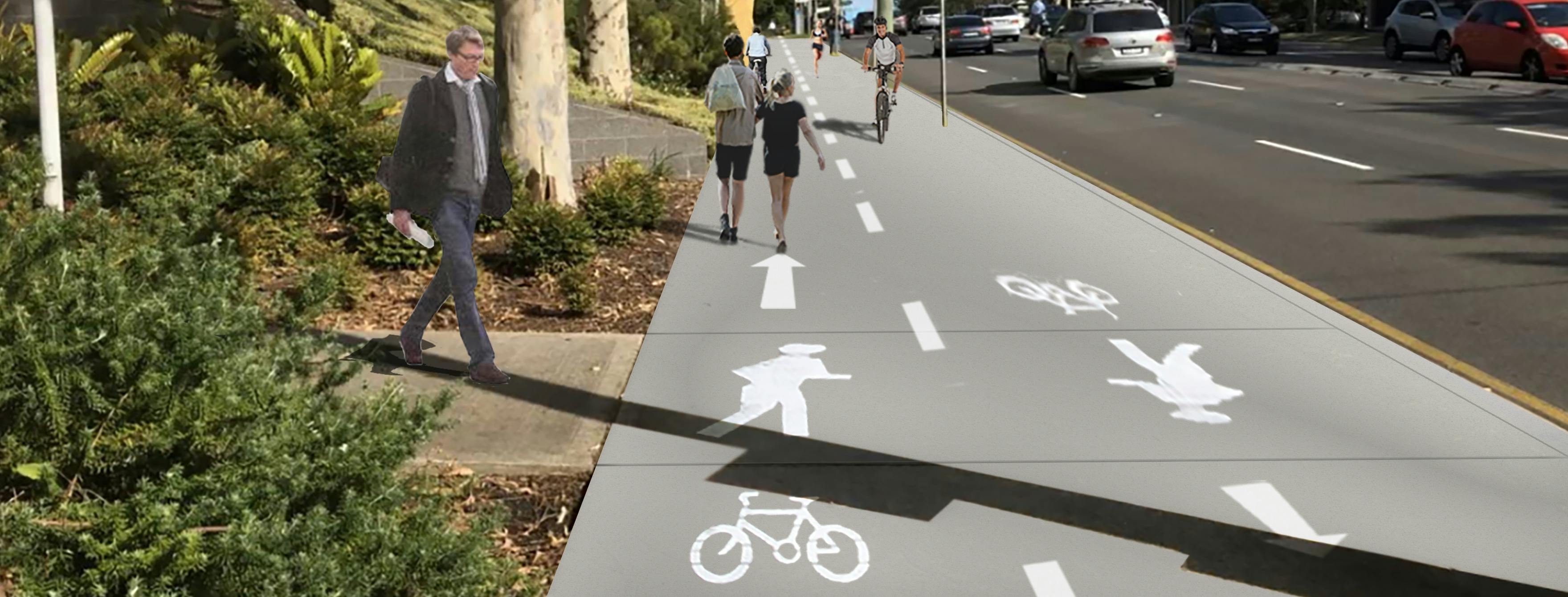
Council wants to hear your thoughts about the draft detailed design plan found on the right-hand side of this page, to provide a safer and connected bicycle route linking Chatswood Central Business District with St Leonards Central Business District using a new shared path along Pacific Highway. Have your say in the survey below or pin the map to provide comment on a specific location along the route before 20 June 2021.
SUBMISSIONS NOW WELCOME ON DRAFT DETAILED DESIGN PLANS
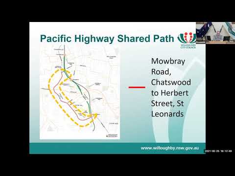
Extensive community consultation on a proposed shared path in Pacific Highway linking Mowbray Road, Chatswood and Herbert Street, St Leonards was undertaken in April and May 2019.
This community feedback informed finalisation of concept design plans endorsed by Council in October 2019. The draft detailed design plans build on the approved concept and provide more information on the changes along the route.
Community feedback on the draft detailed design will assist finalisation of the detailed design to support the community’s needs.
The Pacific Highway shared path forms an important part of Council’s bicycle network.
Pacific Highway Shared Path will connect residents and visitors to retail, service, cultural and recreational uses and transport modes in Chatswood Central Business District (CBD), Lane Cove, Artarmon Local Centre and St Leonards CBD.
The detailed design plan has been funded in the Department of Planning, Industry and Environment Active Transport Links Program (Active Transport Link 1).
PROPOSED CHANGES TO PACIFIC HIGHWAY
Willoughby Council is committed to providing safe and accessible bicycle routes for the community. Safe bicycle routes encourage more people to ride, reduce congestion and support healthier and more active lifestyles. The Pacific Highway Shared Path will provide:
- A shared path along the east side of Pacific Highway
- Connection with bicycle links at Rimmington Street, Gore Hill Freeway, Carlotta Street, Campbell Street and Herbert Street (Active Transport Link 2), see below.
- Bicycle connections and safety improvements at intersections including bicycle lanterns at traffic control signals and kerb build outs at other intersections.
- Improved public domain with additional tree planting, bicyclist amenities, street furniture and landscaping along the route. A small number of existing trees will be removed but many more are proposed to be planted.
- Relocating bus stops and shelters. Providing the shared path at the rear of bus stops where possible to improve amenity and safety.
Proudly funded by the NSW Government in association with Willoughby City Council
A brochure is provided to provide an overview of the project and the detailed design plans.
You can review the detailed design plans in the Detailed design plans for Pacific Highway Shared Path (simplified) section on this page. These plans have been developed to provide the changes in a simple non-technical format.
For those that wish to review the detailed design plans with engineering information, these are provided in the Pacific Highway Shared Path (engineering) section on this page.
Supporting information is also provided should this be helpful.
What happens next?
All comments will be taken into consideration and will contribute to the final detailed design plan.
The final detailed design plans will be considered by the Traffic Committee and forwarded to Council for its final decision.
When are the works planned for?
The next phase of the project is construction of the physical infrastructure. These physical works will follow Council approval of the detailed design plans and funding allocation.
Contact details
If you have any questions about this project please contact Kamoru Adetunmbi, Transport Engineer on 02 9777 1000 or email email@Willoughby.nsw.ov.au.
Your Privacy
The personal information that you have provided on this platform is necessary to enable Council staff to process the information and contact you if required. The personal information will only be viewed by Council staff who have responsibility for processing this information, however may be viewed by others as required by Law.
Please note that the content of your comments made may be made available or reproduced in Council reports.
For further information regarding your privacy please refer to Bang the Table Privacy Policy at https://www.haveyoursaywilloughby.com.au/privacy or the Willoughby City Council’s Privacy Statement viewed here(External link)(External link).
Update
The stakeholder and community feedback received by Council has been considered and incorporated into the draft detailed design plans. The final detailed design plans were considered by the Traffic Committee at its meeting on 18 August 2021 in item 5.7 Pacific Hwy between Mowbray Rd, Chatswood & Herbert St, St Leonards - Shared Path Detailed Design Plans & Construction. The agenda is provided on Council’s website via the link here.
Background
Council wants to hear your thoughts about the draft detailed design plan found on the right-hand side of this page, to provide a safer and connected bicycle route linking Chatswood Central Business District with St Leonards Central Business District using a new shared path along Pacific Highway. Have your say in the survey below or pin the map to provide comment on a specific location along the route before 20 June 2021.
SUBMISSIONS NOW WELCOME ON DRAFT DETAILED DESIGN PLANS
Extensive community consultation on a proposed shared path in Pacific Highway linking Mowbray Road, Chatswood and Herbert Street, St Leonards was undertaken in April and May 2019.
This community feedback informed finalisation of concept design plans endorsed by Council in October 2019. The draft detailed design plans build on the approved concept and provide more information on the changes along the route.
Community feedback on the draft detailed design will assist finalisation of the detailed design to support the community’s needs.
The Pacific Highway shared path forms an important part of Council’s bicycle network.
Pacific Highway Shared Path will connect residents and visitors to retail, service, cultural and recreational uses and transport modes in Chatswood Central Business District (CBD), Lane Cove, Artarmon Local Centre and St Leonards CBD.
The detailed design plan has been funded in the Department of Planning, Industry and Environment Active Transport Links Program (Active Transport Link 1).
PROPOSED CHANGES TO PACIFIC HIGHWAY
Willoughby Council is committed to providing safe and accessible bicycle routes for the community. Safe bicycle routes encourage more people to ride, reduce congestion and support healthier and more active lifestyles. The Pacific Highway Shared Path will provide:
- A shared path along the east side of Pacific Highway
- Connection with bicycle links at Rimmington Street, Gore Hill Freeway, Carlotta Street, Campbell Street and Herbert Street (Active Transport Link 2), see below.
- Bicycle connections and safety improvements at intersections including bicycle lanterns at traffic control signals and kerb build outs at other intersections.
- Improved public domain with additional tree planting, bicyclist amenities, street furniture and landscaping along the route. A small number of existing trees will be removed but many more are proposed to be planted.
- Relocating bus stops and shelters. Providing the shared path at the rear of bus stops where possible to improve amenity and safety.
Proudly funded by the NSW Government in association with Willoughby City Council
A brochure is provided to provide an overview of the project and the detailed design plans.
You can review the detailed design plans in the Detailed design plans for Pacific Highway Shared Path (simplified) section on this page. These plans have been developed to provide the changes in a simple non-technical format.
For those that wish to review the detailed design plans with engineering information, these are provided in the Pacific Highway Shared Path (engineering) section on this page.
Supporting information is also provided should this be helpful.
What happens next?
All comments will be taken into consideration and will contribute to the final detailed design plan.
The final detailed design plans will be considered by the Traffic Committee and forwarded to Council for its final decision.
When are the works planned for?
The next phase of the project is construction of the physical infrastructure. These physical works will follow Council approval of the detailed design plans and funding allocation.
Contact details
If you have any questions about this project please contact Kamoru Adetunmbi, Transport Engineer on 02 9777 1000 or email email@Willoughby.nsw.ov.au.
Your Privacy
The personal information that you have provided on this platform is necessary to enable Council staff to process the information and contact you if required. The personal information will only be viewed by Council staff who have responsibility for processing this information, however may be viewed by others as required by Law.
Please note that the content of your comments made may be made available or reproduced in Council reports.
For further information regarding your privacy please refer to Bang the Table Privacy Policy at https://www.haveyoursaywilloughby.com.au/privacy or the Willoughby City Council’s Privacy Statement viewed here(External link)(External link).


 Listen to Council's Traffic & Transport Team Leader, Gordon Farrelly, explain what types of treatments are proposed along the route of the Pacific Hwy shared path .

